Uranography - a brief overview
Uranography = Sky cartography.
From the Greek words ouranos (=heavens) and graphein (= describing).
The history of the constellations in the sky is as old as mankind itself. From the beginning, people let their fantasy run free when they looked up at the star spangled night sky. Soon they started creating figures out of those dots of light, that always seemed to be in the same places in relation to each other; hunters, bears, lions and dogs. The twelve well-known constellations of the 'zodiac', the constellations that the sun passes through during her yearly path, probably originate from the old Babylon.
In later centuries many of the old constellations were given new names, based on the stories from the Greek Mythology; Andromeda, Cassiopeia, Cepheus, Perseus and many more. The first serious inventory of the sky was made by the Greek Claudius Ptolemeus (or Ptolomy), halfway the second century. His work contains a list of 48 constellations, that are still used today and the names can be found on modern star maps.
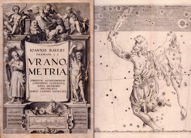
There were still no constellations formed in a part of the sky around the southern celestial pole, invisible from the Mesopotamian and Mediterranium areas. The constellations we now know in this part of the sky came from the 16th, 17th and 18th century. Many were 'invented' by two Dutch seafarers, Keyser and De Houtman (and probably Peter Plancius, a scientist from Amsterdam), and the French astonomer De Lacaille. Some interesting star atlases from this period are Uranometria by Johannes Bayer (1603), Firmamentum Sobiescianum Sive Uranographia, by Johannes Hevelius (1687) and Atlas Coelestis by John Flamsteed (1729).
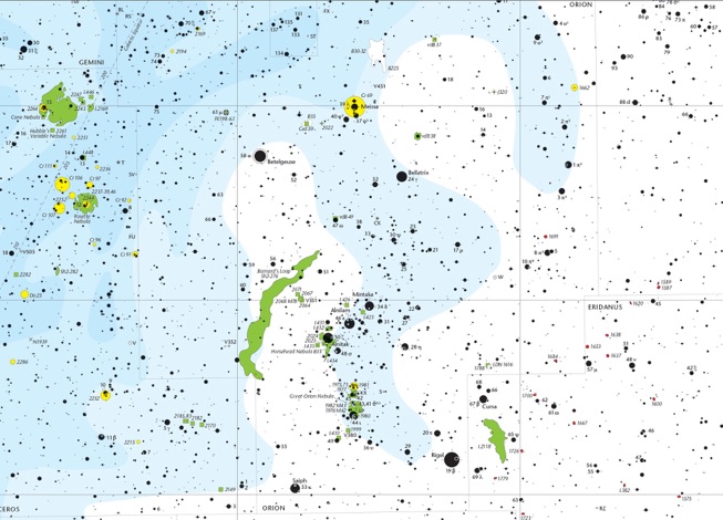
On the old sky maps, the emphasis was on the classical constellation figures, that dominated the stars. Sometimes the stars were complete absent. After the invention of the telescope this slowly changed. Stars now gained more priority and the drawn, classical figures become less prominent and eventually they completely disdappeared from the star maps. More attention was given to the accurate positions of stars and objects. Pioneer work in this field was done by the German astronomer Friedrich Argelander. In 1875 he published a catalog with positions of 325,000 stars, measured from behind the telescope by himself and a group of assistants. Using the catalogue, a series of star maps was created. Just a coordinate grid and stars, nothing else was shown. The work became known as the Bonner Durchmusterung. It was unique until 1966 when a comparable work was published; the S.A.O. Star Catalogue plus the first computer-plotted atlas, the S.A.O. Star Atlas. In the eighties and the nineties of the twentiest century several large star catalogs were compiled, such as the Hubble and the Hipparcos/Tycho catalogs, based on the observations of space telescopes.
Over the past century many photographic star atlases have been created and published. The best known example is probably the Palomar Sky Survey. But also more affordable photographic atlases like the Falkauer Atlas and Atlas Stellarum 1950.0 by the German amateur astronomer Hans Vehrenberg.
A few of the best-known hand-drawn star atlases for the serious amateur are Norton's Star Atlas, by Arthur Norton and Atlas Coeli Skalnate Pleso, by Dr. Antonin Becvar. This atlas was succeeded in 1982 by Sky Atlas 2000.0 by Wil Tirion. A Second Edition, that appeared in 1997 was created with the aid of computertechniques.
Wil Tirion, September 2, 2013